Feasibility Studies
Before investing: what geological maps, borehole archives, terrain models and satellite images already reveal about a site – and where the ground investigation needs to start. For photovoltaic and wind farms, data centres, routes and commercial sites, we evaluate the available data, identify ground and environmental risks early and place the ground investigation where it provides answers. For investors, banks, local authorities and project developers – in Germany and across Europe, applying the standards and National Annexes of the country concerned.
Send a project enquiryor call: +49 157 88 330112
OFFICIAL · ARCHIVE · SATELLITE
FROM GROUNDWATER TO UXO
TARGETED INVESTIGATION AFTERWARDS
REPORT DE · EN
What is already known about the site
Data exist for almost every site in Germany – scattered, and to a different extent in each federal state. We combine them in a single georeferenced model and extract them by machine before a person evaluates them.
Geological map interpretation
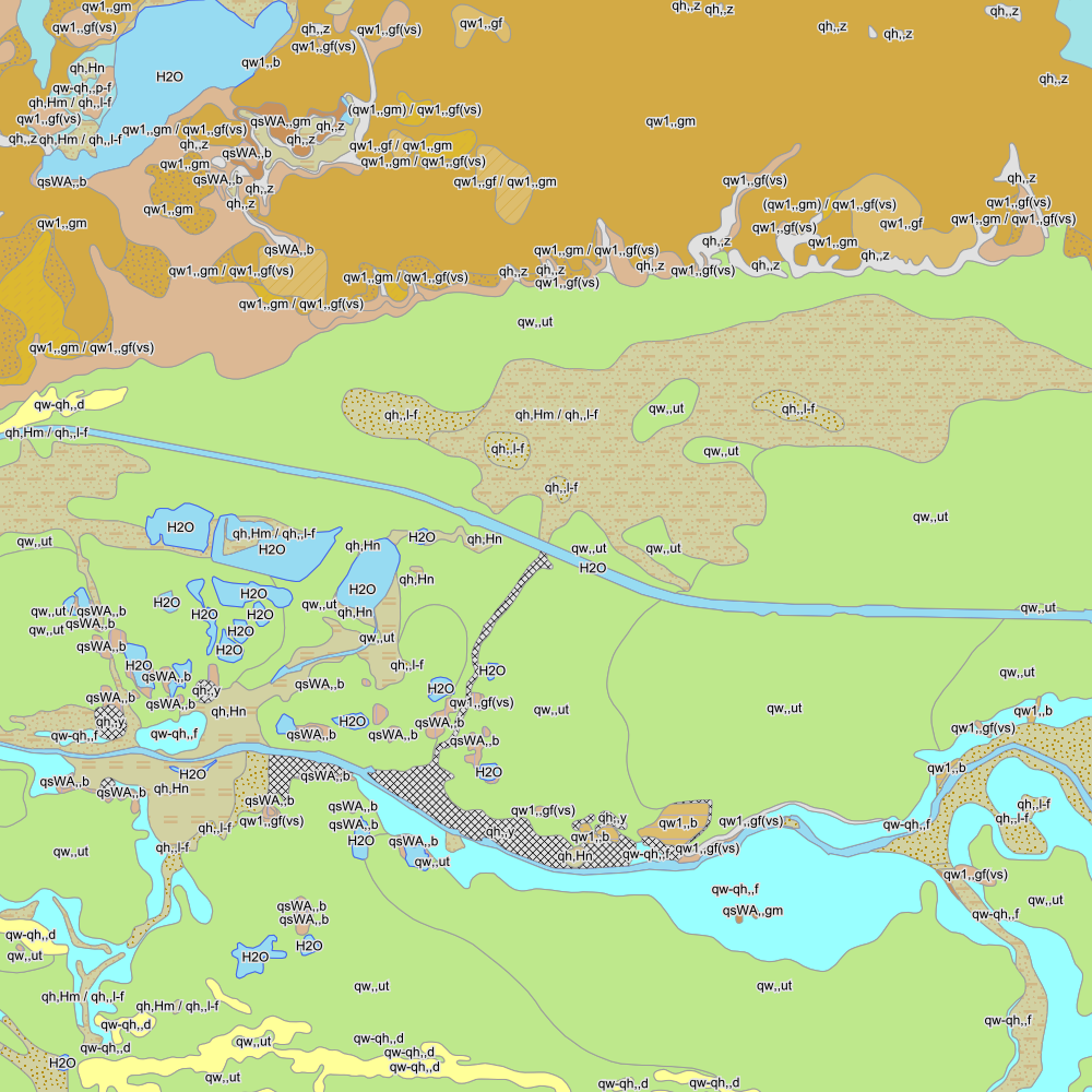
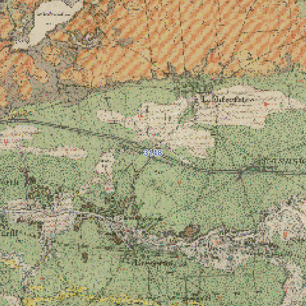
Current geological maps of the federal states, national overview maps and the historical geological maps at 1 : 25 000 (1875–1969), which in places show more detail than today's overview maps. Map units and symbols are read out by image classification and intersected to define soil zones.
GK25 · GÜK200 · Geologische Karte von Preußen (Geological Map of Prussia) · image classification (CNN) · pattern recognitionBorehole archive and database search
The BGR borehole register (BGR = Federal Institute for Geosciences and Natural Resources), the borehole archives of the state geological surveys, released borehole logs from state archives and earlier reports – location, depth and sequence of strata are extracted from texts and scans and assigned to the site model.
German borehole register (Deutscher Bohrungsnachweis) · state borehole archives under GeolDG (Geological Data Act) · text extraction (NLP) · semantic searchTerrain model and satellite image time series
Digital terrain models and LiDAR reveal channels, depressions, former pits and made ground; multispectral satellite images covering ten years reveal moisture zones, vegetation anomalies and land-cover changes. Where measurement points exist (buildings, transport routes), the Ground Motion Service (BodenBewegungsdienst) provides indications of ground movement from radar interferometry.
DGM1 (DTM) · LiDAR · Sentinel-2 time series · change detection · vegetation and moisture indices · InSAR (BBD)What a site can cost
Eight risks that govern the foundation, permitting or schedule of a major project – each with the data source from which it can be identified before the ground investigation.
Drilling where the answers are
The outcome of the desk study is not a gut feeling but a reasoned investigation plan – and a risk assessment on which investors, banks and local authorities can base their decisions.
Cluster analysis and investigation plan
Homogeneous soil zones are computed from maps, relief and spectral data. The number and location of exploratory points follow the zones and risks, within the spacings given in DIN EN 1997-2, Annex B.3; the depth follows the structure. On large sites, the desk study has a considerable influence on drilling costs.
Cluster analysis · georeferenced ground model · investigation optimisation · DIN EN 1997-2Site and route comparison, due diligence
Several sites or route options assessed with the same method and compared in a matrix – before land acquisition, before tendering, before financing.
Options study · assessment matrix · risk indicators before the investigation · due diligenceProjects in Europe
For sites outside Germany, we research the country's applicable standards, National Annexes and permitting procedures, evaluate its geodata services and deliver the report in German or English.
Eurocode 7 and 8 with National Annex · national geodata services · report DE · ENOne site, five data layers
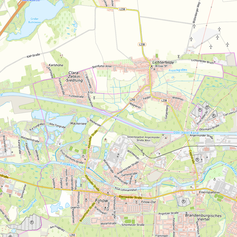
SHEET 3 · DATA STACK · 6 × 6 km · OFFICIAL SERVICESThe same section in five official maps. Each layer answers a different question – only together do they give the picture from which the soil zones and the investigation plan are derived.


What a desk study delivers for each project type
PROJECT TYPE · KEY QUESTION · TYPICAL RISKS · RESULT| Project type | Key question before the investment | Typical site risks | Result of the desk study | Standards |
|---|---|---|---|---|
| Ground-mounted photovoltaics10–200 ha | Where can driven posts be installed – and where not? | Peat and organic lake mud, high groundwater level, boulders, unexploded ordnance, archaeological monuments | Zone map of drivability · investigation plan with dynamic probing per zone | DIN EN 1997-2 · DIN 4020 |
| Wind energyPER SITE | Will the ground support a shallow foundation, or is a deep foundation needed? | Soft layers at foundation depth, groundwater, differential settlement, seismic action | Foundation forecast per site · investigation depth and type of exploration according to turbine type | DIBt guideline · DIN EN 1998-1/NA |
| Data centre, industrial hall, storage facilityHIGH LOADS | Will the ground support settlement-sensitive installations? | Made ground, contaminated sites, organic layers, groundwater for excavation and cooling | Risk map · settlement estimate (order of magnitude) from archive and map · environmental sampling plan | DIN 4020 · BBodSchV · EBV |
| Routes and utility linesKM BY KM | Where are the critical sections, and where is an open trench sufficient? | Crossings, peatland sections, groundwater, rock, mining, unexploded ordnance | Risk sections by chainage · proposed crossing method: HDD, pipe jacking or open-cut · investigation per section | DIN EN 1997-2 · DVGW GW 321 · VOB/C DIN 18324 |
| Land before purchaseDUE DILIGENCE | What costs are hidden in the ground? | Contaminated sites, material and landfill classes, additional foundation costs, permitting hurdles | Cost risks with range · cost estimates for purchase price negotiations · recommendation for the investigation | BBodSchV · EBV · DepV · DIN 4020 |
| Site in EuropeEUROPE | Does the same apply here as in Germany? | Different National Annexes, seismic zones, karst, permitting procedures, language | Study to national standards · national geodata services evaluated · report DE or EN | EN 1997 / EN 1998 with the country's NA |
Request a desk study
Send us the location and type of your project – we will tell you what data are available, which risks are involved and what the desk study costs. Also for sites outside Germany.
Send a project enquiryGoerzallee 299 · 14167 Berlin
+49 157 88 330112
info@geostudys.com